Blue Mounds State Park
Lower and Upper Cliffline Trails

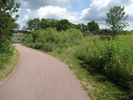
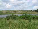
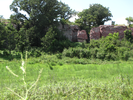
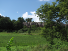
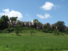
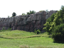
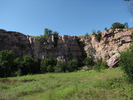
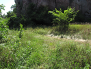
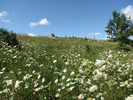
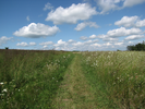
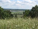
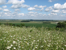
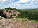
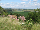
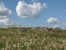
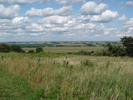
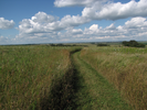
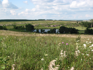
Long prairie views punctuated by upthrust rock, blue sky above and blue water in the distance, Blue Mounds is a visual delight. At every point on the trail there is something to see, both near and in the distance.
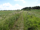
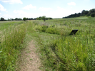
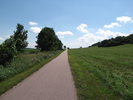
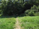
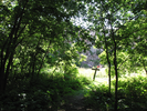
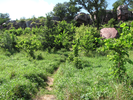
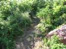
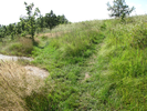
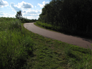
The trail itself is diverse - tracing straight lines on flat prairie, winding and climbing through deep woods amidst boulders, then curving through rolling tall grass prairie.
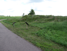
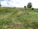
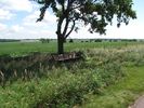
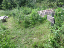
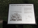
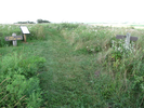
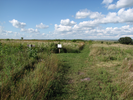
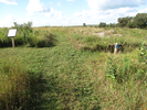
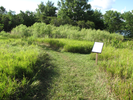
Midway along the hike is a mysterious line of rocks that crosses the trail. The rock alignment is long - more than 1,200 feet. It's not very obvious when the grass is tall, but it is very evident in the early spring.
From what I've read, the purpose and origin of the alignment is not known. Take a visit - maybe you will be the one to unravel the enigma!
- Approach
-
From the intersection of County Hwy 4 and Interstate Hwy 75 in Luverne, Minnesota, head north on Hwy 75 4.4 miles to the entrance to Blue Mounds State Park.
Turn right, and follow the entrance road east 1.6 miles to a grassy parking lot loop at the end of the road.
There is a park building along the road where you will need to pay a fee to enter the park.
Coordinates for the hike: 43.7142670,-96.1816540
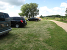
- Parking / Trailhead amenities
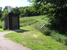
- The parking lot is mostly grass and has plenty of room for cars. Adjacent to the parking lot are a pair of pit toilets, a volleyball court, a picnic area, and a swimming beach.
- Trail observations
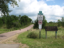
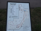
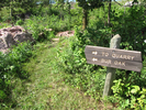
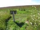
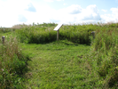
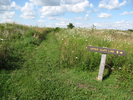
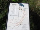
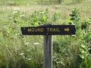
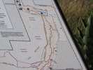
- The trail begins at the entrance to the parking lot loop. There are two signs at the trailhead that list the various trails that coexist for the first part of the trail. There is a green sign for the "Blue Mound Trail", and a redwood sign for the "Upper Cliff Line Trail", the "Lower Cliff Line" trail, and the "Mound Creek Trail". For the first half of the hike you will be following the Lower Cliff Line trail and returning by the Upper Cliff Line trail.
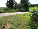
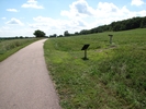
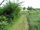
The trail is paved for a 0.3 miles, then follows a grassy railroad grade for 0.8 miles till it joins the paved path again for 0.6 miles. After that the trail ascends to the upper prairie and returns along a grass and dirt trail. The upper cliff line trail is often damp and sometimes wet.
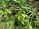
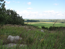
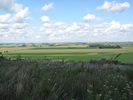
The trail has long sweeping views, of the cliffs, of the prairie, and of the surrounding farmlands. In the summer the prairie is a riot of blossoms - the rest of the seasons are equally spectacular.
I love this trail, and hike it whenever I can. - Trail statistics
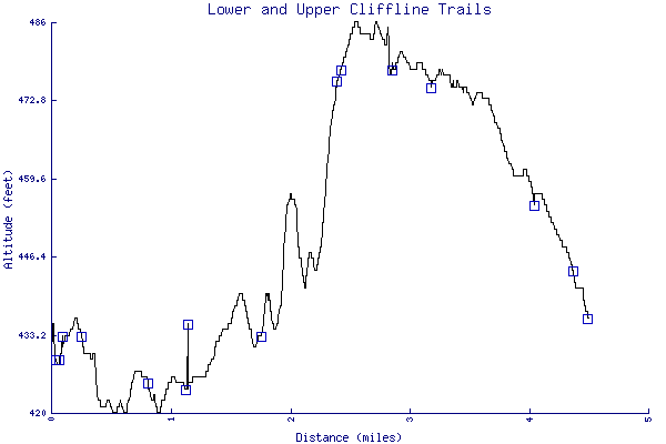
- The trail is 4.49 miles long. The sum of all the uphill climbs is 152 feet.
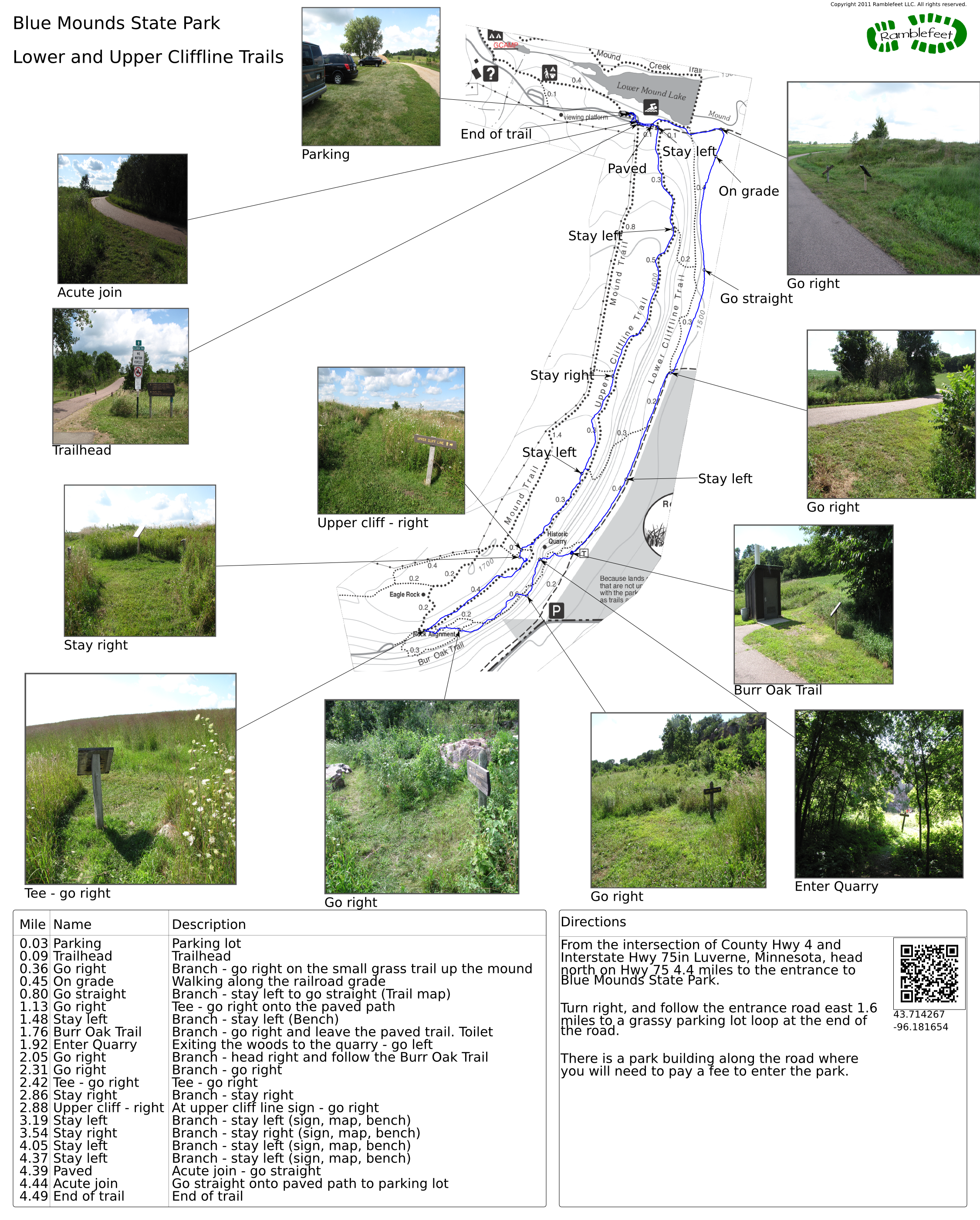
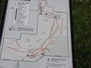
- Trail waypoints
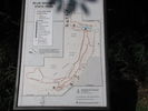
0.03 mi Parking Parking lot 0.09 mi Trailhead Trailhead 0.36 mi Go right Branch - go right on the small grass trail up the mound 0.45 mi On grade Walking along the railroad grade 0.80 mi Go straight Branch - stay left to go straight (Trail map) 1.13 mi Go right Tee - go right onto the paved path 1.48 mi Stay left Branch - stay left (Bench) 1.76 mi Burr Oak Trail Branch - go right and leave the paved trail. Toilet 1.92 mi Enter Quarry Exiting the woods to the quarry - go left 2.05 mi Go right Branch - head right and follow the Burr Oak Trail 2.31 mi Go right Branch - go right 2.42 mi Tee - go right Tee - go right 2.86 mi Stay right Branch - stay right 2.88 mi Upper cliff - right At upper cliff line sign - go right 3.19 mi Stay left Branch - stay left (sign, map, bench) 3.54 mi Stay right Branch - stay right (sign, map, bench) 4.05 mi Stay left Branch - stay left (sign, map, bench) 4.37 mi Stay left Branch - stay left (sign, map, bench) 4.39 mi Paved Acute join - go straight 4.44 mi Acute join Go straight onto paved path to parking lot 4.49 mi End of trail End of trail


- Keywords
- Difficulty: Easy
- Terrain : Flat
- Terrain : Hilly
- Trail surface: Dirt
- Trail surface: Grassy
- Trail surface: Paved
- Type: Loop
- View: Open
- View: Wooded
- County: Rock
- State: South Dakota
- Country: United States of America
- Resources
- Printable trail map in PDF format (33 Mb download)
- Printable trail map in PNG format (5 Mb download)
- Waypoints in CSV format
- Waypoints in KML format
- Instructions on using a trail description page
- Instructions on using a trail map printout
- Trails in the surrounding area
- Area map for Minnesota, North Dakota, and South Dakota (3 additional trails)
- Area map for Minnesota, North Dakota, South Dakota, and Wisconsin (6 additional trails)
- Area map for Iowa, Minnesota, Nebraska, and South Dakota (3 additional trails)
- Area map for Iowa, Minnesota, Nebraska, and South Dakota (5 additional trails)
Copyright © 2011 RambleFeet LLC. All rights reserved.