Devil's Lake State Park
East and West Bluff Trails
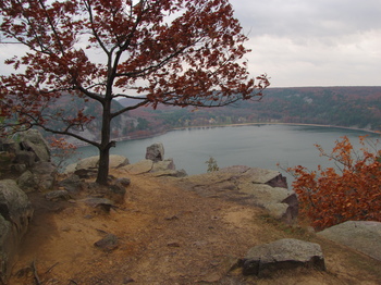
Hiking at Devils Lake seems overshadowed by all the other activities in the park and nearby. I've heard lots about the Wisconsin Dells, and how great the climbing is at Devils Lake, and I've noticed the beach is always packed during the summer, but I've never hear much about the hiking trails. That's a shame, because the hike along the bluffs is one of the most scenic hikes I know of.
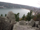
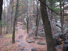
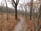
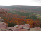
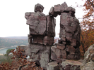
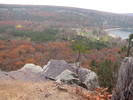
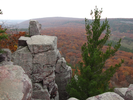
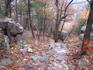
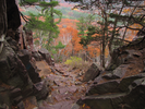
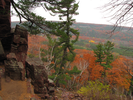
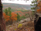
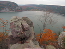
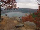
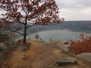
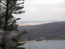
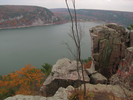
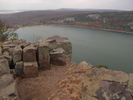
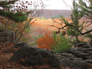
The trail follows both bluffs, sometimes as high as 500 feet above the lake. Along the trail are amazing stone formations. In the fall the colors are spectacular, and the fall foliage can be seen for miles from the tops of the bluffs.
This is a must visit destination and a must hike trail for anyone living in Wisconsin or Minnesota.
- Approach
-
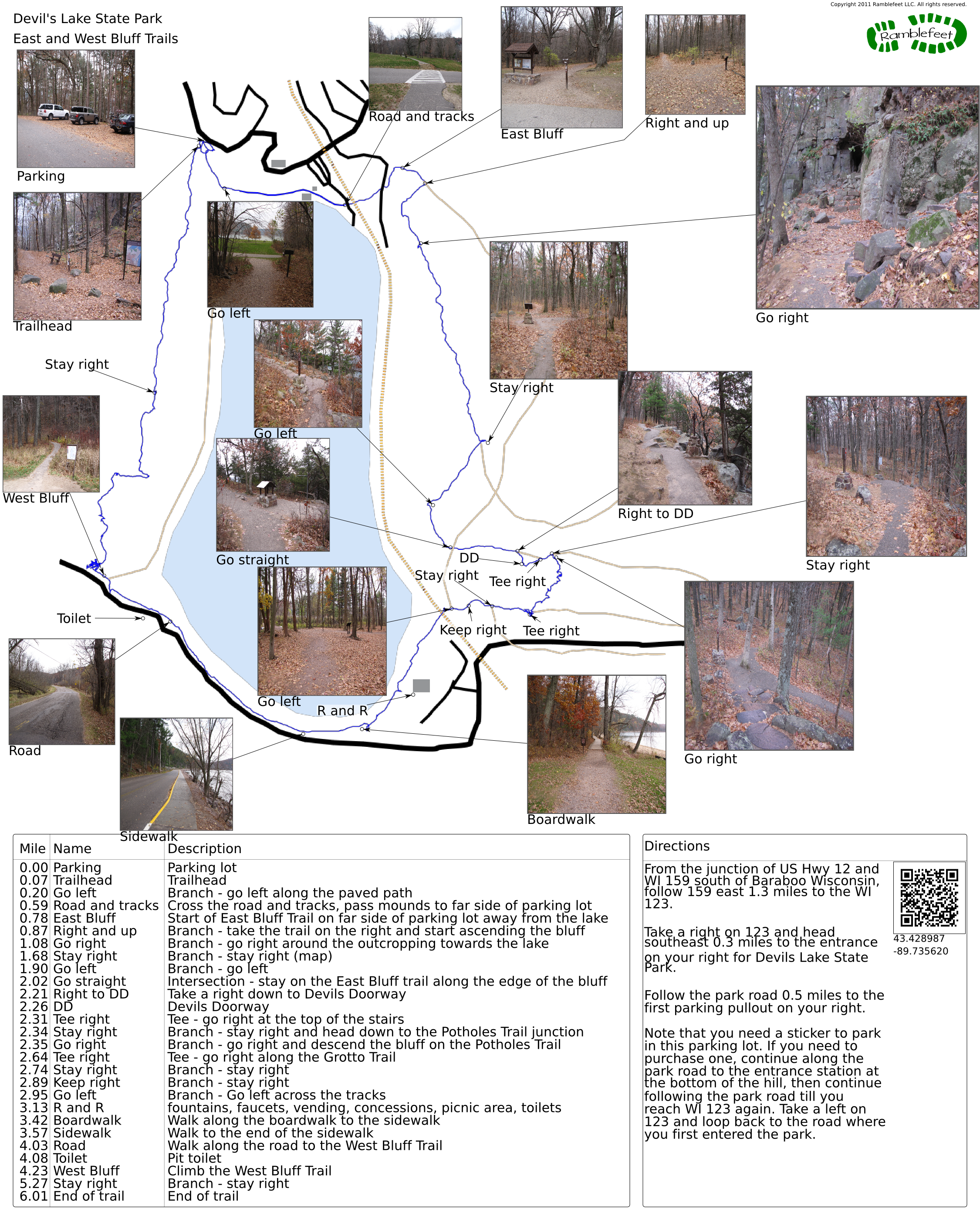
From the junction of US Hwy 12 and WI 159 south of Baraboo Wisconsin, follow 159 east 1.3 miles to WI 123.
Take a right on 123 and head southeast 0.3 miles to the entrance on your right for Devils Lake State Park.
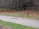
Follow the park road 0.5 miles to the first parking pullout on your right.
Note that you need a sticker to park in this parking lot. If you need to purchase one, continue along the park road to the entrance station at the bottom of the hill, then continue following the park road till you reach WI 123 again. Take a left on 123 and loop back to the road where you first entered the park.
Coordinates for the hike: 43.4289870,-89.7356200
- Parking / Trailhead amenities
- The paved parking pullout has room for about 10 cars. I've never had troubles getting a spot, but if you do you can continue down the hill and park down by the beach. The trail is a well marked loop, so it doesn't make too much difference where you park along the route.
- Trail observations
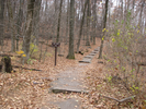
- The trails exits from the right side of the parking lot and heads steeply down to the lake. At the lake, take a left and follow the paved path as it goes between the rental building and the concession stand. The path will cross a road and then a railroad track, and end in a meadow with several burial mounds.
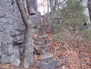
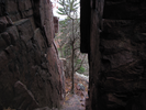
Head gradually away from the lake towards a parking lot - on the far side of the parking lot follow the signs to the East Bluff Trail. Follow the East Bluff trail as it climbs to the top of the bluff. Take the short side trail to the Devil's Doorway, then descend the bluff along the Potholes Trail. Note that the very steep rock steps on the descent can be slippery - wear grippy shoes and take your time.
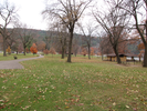
Walk along the shoreline, through the picnic grounds, along a boardwalk, then along a sidewalk, and finally on the shoulder of the road till you reach the West Bluff Trail. Ascend the West Bluff Trail and follow it back to the parking lot. - Trail statistics
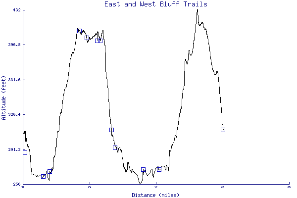
- The trail is 6.01 miles long. The sum of all the uphill climbs is 463 feet.
- Trail waypoints
0.00 mi Parking Parking lot 0.07 mi Trailhead Trailhead 0.20 mi Go left Branch - go left along the paved path 0.59 mi Road and tracks Cross the road and tracks, pass mounds to far side of parking lot 0.78 mi East Bluff Start of East Bluff Trail on far side of parking lot away from the lake 0.87 mi Right and up Branch - take the trail on the right and start ascending the bluff 1.08 mi Go right Branch - go right around the outcropping towards the lake 1.68 mi Stay right Branch - stay right (map) 1.90 mi Go left Branch - go left 2.02 mi Go straight Intersection - stay on the East Bluff trail along the edge of the bluff 2.21 mi Right to DD Take a right down to Devils Doorway 2.26 mi DD Devils Doorway 2.31 mi Tee right Tee - go right at the top of the stairs 2.34 mi Stay right Branch - stay right and head down to the Potholes Trail junction 2.35 mi Go right Branch - go right and descend the bluff on the Potholes Trail 2.64 mi Tee right Tee - go right along the Grotto Trail 2.74 mi Stay right Branch - stay right 2.89 mi Keep right Branch - stay right 2.95 mi Go left Branch - Go left across the tracks 3.13 mi R and R fountains, faucets, vending, concessions, picnic area, toilets 3.42 mi Boardwalk Walk along the boardwalk to the sidewalk 3.57 mi Sidewalk Walk to the end of the sidewalk 4.03 mi Road Walk along the road to the West Bluff Trail 4.08 mi Toilet Pit toilet 4.23 mi West Bluff Climb the West Bluff Trail 5.27 mi Stay right Branch - stay right 6.01 mi End of trail End of trail
- Keywords
- Difficulty: Moderate
- Feature: Rock climbing
- Terrain: Hilly
- Trail surface: Paved
- Type: Loop
- View: Open
- View: Overlooks
- View: Wooded
- County: Adams
- State: Wisconsin
- Country: United States of America
- Resources
- Printable trail map in PDF format (48 Mb download)
- Printable trail map in PNG format (5 Mb download)
- Waypoints in CSV format
- Waypoints in KML format
- Instructions on using a trail description page
- Instructions on using a trail map printout
- Trails in the surrounding area
- Trailheads for Michigan and Wisconsin (1 additional trail)
- Trailheads for Illinois Iowa, Minnesota, and Wisconsin (10 additional trails)
- Trailheads for Illinois Iowa, and Wisconsin (4 additional trails)
- Trailheads for Illinois Iowa, Minnesota, and Wisconsin (3 additional trails)
- Trailheads for Illinois Iowa, and Wisconsin (3 additional trails)
Copyright © 2011 RambleFeet LLC. All rights reserved.