Theodore Roosevelt National Park
Caprock Coulee Trail
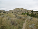
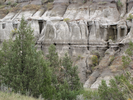
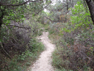
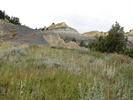
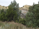
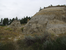
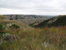
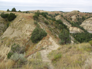
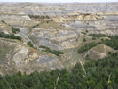
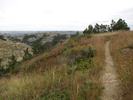
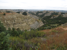
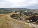
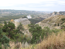
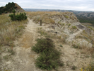
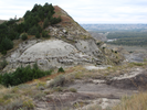
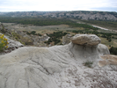
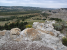
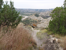
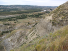
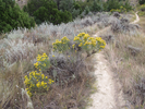
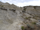
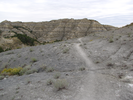
The Caprock Coulee Trail is a great way to experience the wonder of Theodore Roosevelt National Park. The trail starts in a badlands canyon, giving close up views of the intricately eroded land. Slowly the trail climbs, the views growing ever more expansive till suddenly you are at the rim looking across the elaborately carved canyons below.
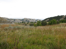
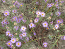
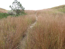
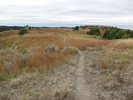
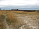
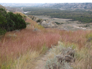
For a while the trail crosses grasslands, a flowing landscape of color and light, to emerge at a wide valley holding long views of the Little Missouri River far below. The quiet along the trail is profound, punctuated only by the whisper of wind and the small sounds of insect and bird.
In every way, this is a trail to be treasured.
- Approach
-
From the junction of I94 and ND22 in Dickinson North Dakota, head west on I94 18.9 miles to Interstate Hwy 85.
Turn right on US-85 and head north for 51.2 miles to the entrance to Theodore Roosevelt National Park.
Take a left and follow the park road 6.4 miles to the Caprock Coulee Trailhead parking lot.
Note that just after you enter the park, there is a visitors center where you will need to pay a fee to park.
Coordinates for the hike: 47.6097800,-103.3563520
- Parking / Trailhead amenities
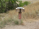
- The parking lot is paved and has room for a fair number of cars. There are no facilities at the parking lot.
- Trail observations
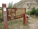
- At the trailhead there are brochures, a map board, and a trail register.
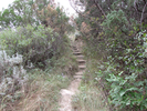
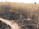
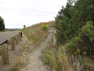
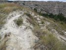
The trail is a big loop that starts out following a canyon, then climbs to the upper prairie and returns along the bluffs above the Little Missouri River. The trail is narrow and often overgrown - wear long pants! Generally the trail is easy to follow and in good shape, though I suspect it could be tough going in spots after a rain storm.
The canyon sections of the trail cut through fairly dense brushy cover. I couldn't help but notice a lot of evidence of bison in the area - I think it would be a really good idea to be very aware of your surroundings through this section. A surprised bison can't possibly be a good thing... - Trail statistics
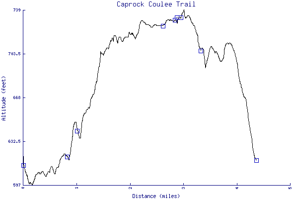
- The trail is 4.37 miles long. The sum of all the uphill climbs is 264 feet.
- Trail waypoints
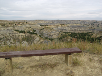
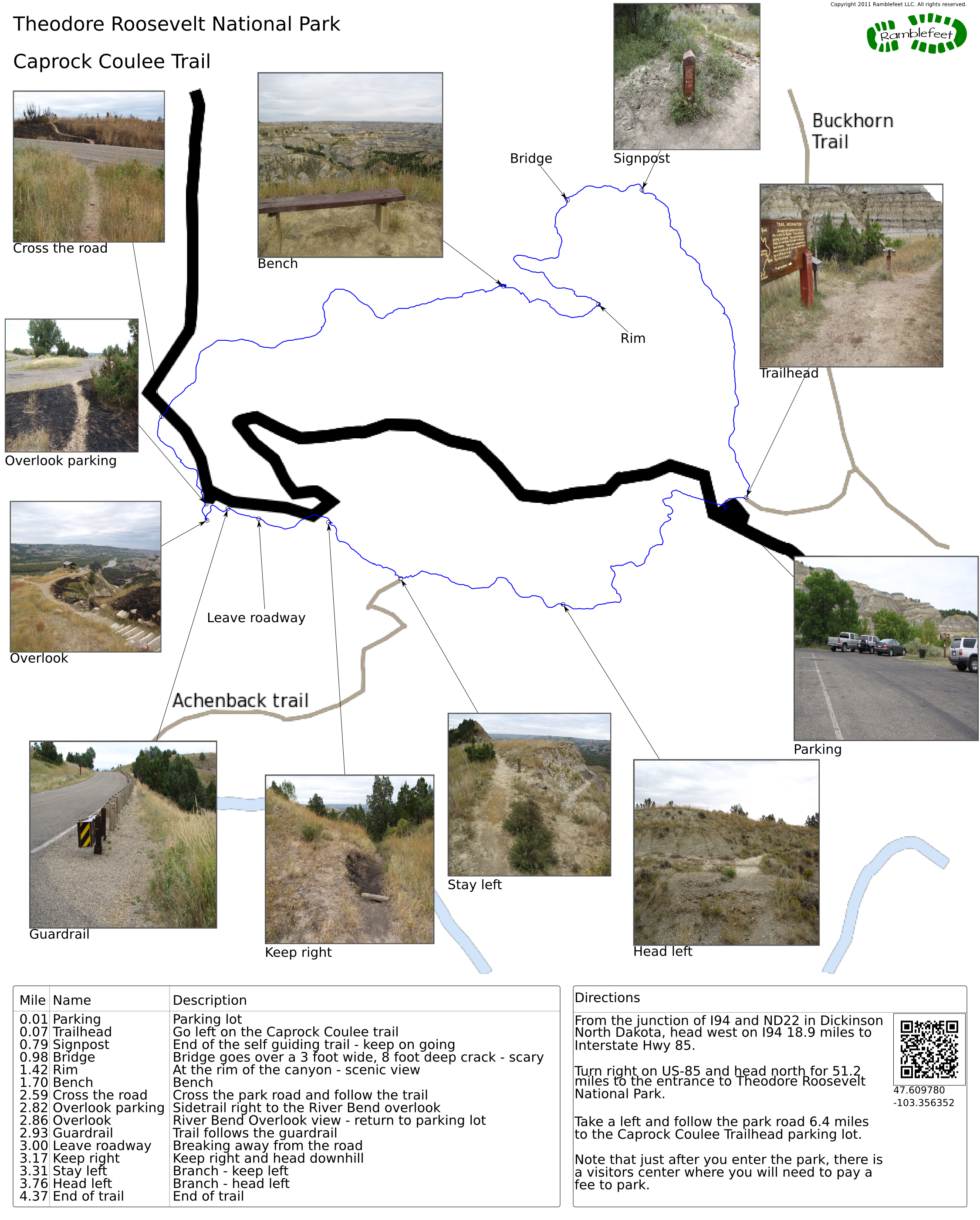
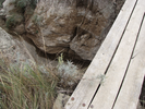
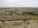
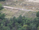
0.01 mi Parking Parking lot 0.07 mi Trailhead Go left on the Caprock Coulee trail 0.79 mi Signpost End of the self guiding trail - keep on going 0.98 mi Bridge Bridge goes over a 3 foot wide, 8 foot deep crack - scary 1.42 mi Rim At the rim of the canyon - scenic view 1.70 mi Bench Bench 2.59 mi Cross the road Cross the park road and follow the trail 2.82 mi Overlook parking Sidetrail right to the River Bend overlook 2.86 mi Overlook River Bend Overlook view - return to parking lot 2.93 mi Guardrail Trail follows the guardrail 3.00 mi Leave roadway Breaking away from the road 3.17 mi Keep right Keep right and head downhill 3.31 mi Stay left Branch - keep left 3.76 mi Head left Branch - head left 4.37 mi End of trail End of trail

- Keywords
- Difficulty: Moderate
- Terrain: Badlands
- Terrain: Canyon
- Terrain: Hilly
- Trail surface: Dirt
- Type: Loop
- View: Enclosed
- View: Open
- County: Richland
- State: North Dakota
- Country: United States of America
- Links
- National Geographic page about the park
- National Park Service web sitei
- Lots of useful information about the park and things to do in the area
- Resources
- Printable trail map in PDF format (24 Mb download)
- Printable trail map in PNG format (4 Mb download)
- Waypoints in CSV format
- Waypoints in KML format
- Instructions on using a trail description page
- Instructions on using a trail map printout
- Trails in the surrounding area
- Trailheads for Montana and North Dakota (No additional trails)
- Trailheads for Montana and North Dakota (No additional trails)
- Trailheads for Montana and North Dakota (No additional trails)
- Trailheads for Montana and North Dakota (No additional trails)
Copyright © 2011 RambleFeet LLC. All rights reserved.